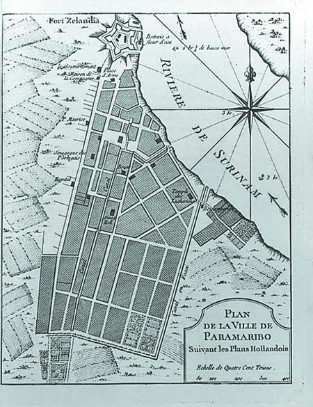
I recently acquired a map printed in Paris in 1764 that serves as a reminder of a once thriving Jewish community.
Suriname – a country on the northeastern Atlantic coast of South America – boasts few Jews today, but centuries ago it was home to a sizable and wealthy Jewish community. In 1639, the British, who controlled Suriname, allowed Jews to settle in the area, and several Jewish families from Portugal, Italy, and the Netherlands took advantage of the opportunity.
‘);
_avp.push({ tagid: article_top_ad_tagid, alias: ‘/’, type: ‘banner’, zid: ThisAdID, pid: 16, onscroll: 0 });
Some of the Jews expelled from Recife, Brazil in 1654 by the Portuguese also settled in Suriname, and, not long after, Suriname was one of the most important Jewish population centers in the Western Hemisphere. Jews prospered as plantation owners.

The map I acquired – titled “Plan De La Ville De Paramaribo, Suivant Les Plans Hollandois” – was drawn by French cartographer Jacques Nicolas Bellin (1703-72) and shows Surinam’s capital city of Paramaribo, including the locations of the synagogues of the Spanish-Portuguese Jews (Tzedek VeShalom, est. 1736) and Ashkenazi Jews (Neveh Shalom, est. 1719).
In 1712, a French Navy captain, Jacques Cassard, raided Surinam and imposed heavy taxes on its residents. These taxes, plus a general economic decline, brought about the emigration of many of Suriname’s Jews. Today, only Neve Shalom’s structure still serves as a synagogue for the area’s few remaining Jews.
‘);
_avp.push({ tagid: article_top_ad_tagid, alias: ‘/’, type: ‘banner’, zid: ThisAdID, pid: 16, onscroll: 25 });


